This post is a compilation several maps of Harlem, a neighborhood in NYC, to help you navigate and find out what there is to see and do here.
WHERE IS HARLEM LOCATED?
The neighborhood of Harlem is big. It runs from the northern tip of Central Park at 110th St. all the way up to 155th St.
Its western border touch the Hudson River and Morningside Heights and its easternmost boundary touch the East River and East Harlem.
It also touches the Upper West and East Sides of Manhattan.
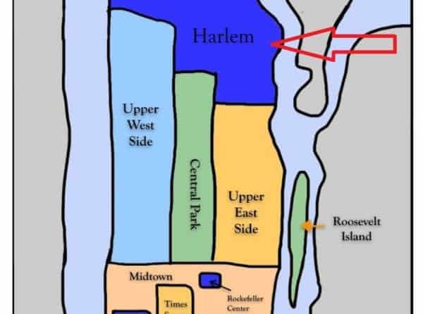
The center of Harlem is located approximately 4 miles (6.5 km) north of Times Square. By subway, it takes approximately 20 minutes to make the trip.
The MTA (Mass Transit Authority) also has a subway and bus map of Harlem.
If you are unfamiliar with public transport in NYC, then be sure to read our posts on how to use the NYC subway and which MetroCard to buy.
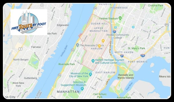
TOURIST MAP OF HARLEM
Below is a map of the top attractions in Harlem. It's interactive. You can enlarge it. You can use it on a smartphone.
Each lettered pin contains images and text explaining each location.
Click the map to open a larger, interactive version.
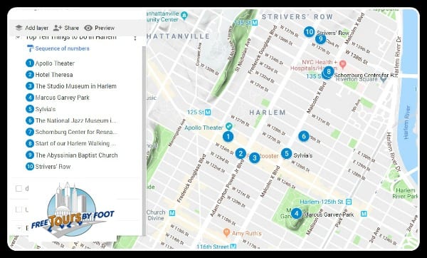
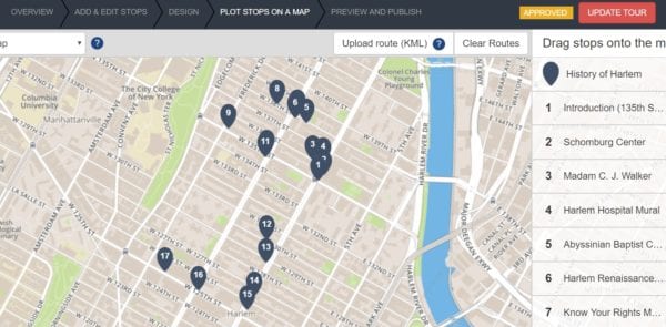
Below is a map of our self-guided audio tour of Harlem.
IDEA: Why not let us show you around Harlem? We offer daily, pay-what-you-wish tours of Harlem.
RELATED CONTENT