People usually don’t associate Washington DC with nature, hiking, and camping.
They immediately think of the majestic Capitol, the White House, the Lincoln Memorial, the Washington Monument and incredible museums.
As a local, I know where to go to enjoy some truly beautiful nature and escape the urban jungle.
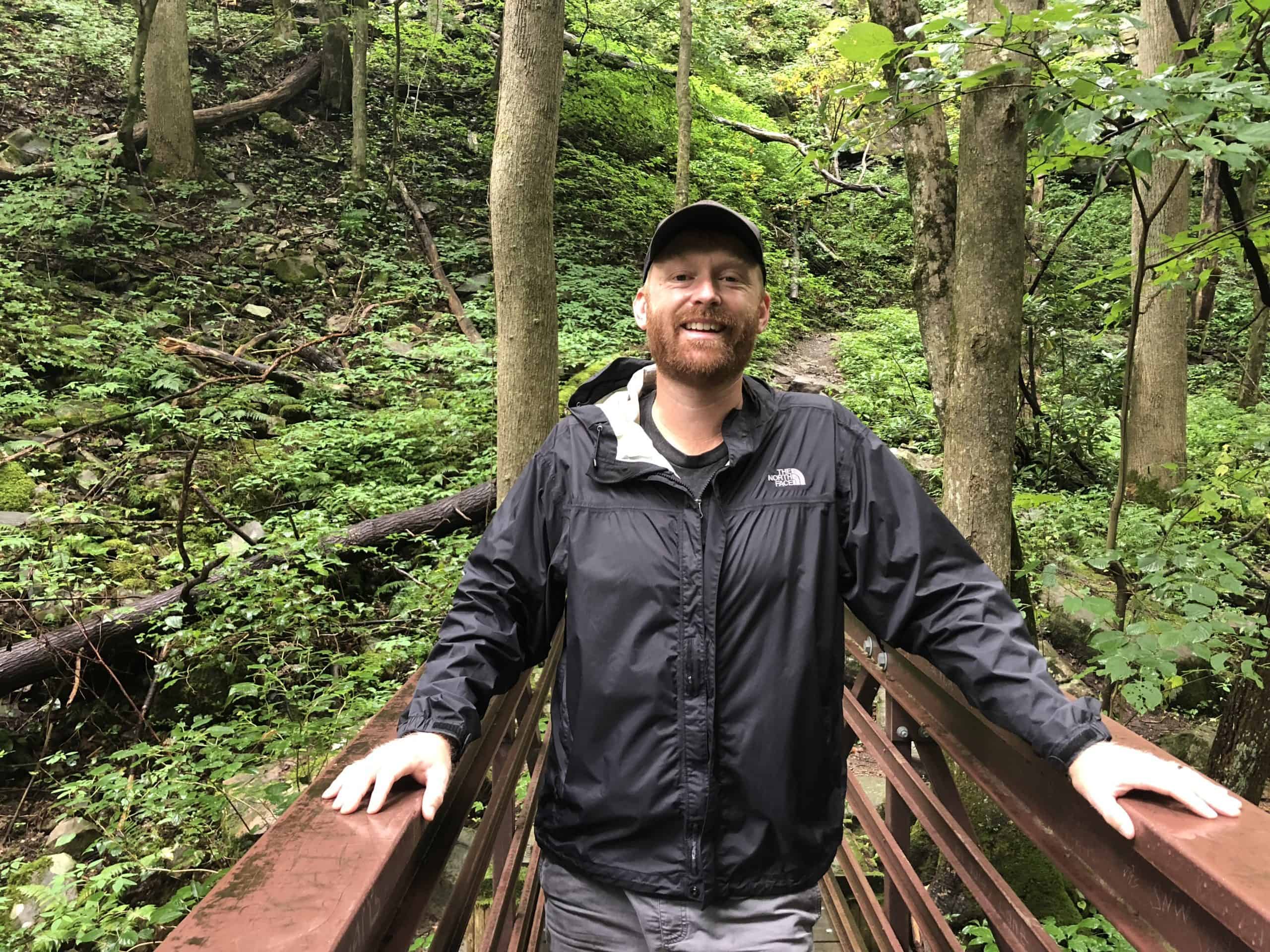
In this post, I'll share with you my favorite outdoor activities in and around Washington DC, including two that I lead 2-hour hiking tours.

Besides my thoughts, at the bottom of this post, you can see what members of our Washington DC Travel Tips Facebook Group have to say about their favorite hiking spots.
Our group has over 55,000 members who are locals, regular visitors, and newbies to DC who are happy to share their insights about the city.
You don't need to become a member to read the posts, comments, and recommendations.
So check out the group after you've read this post!
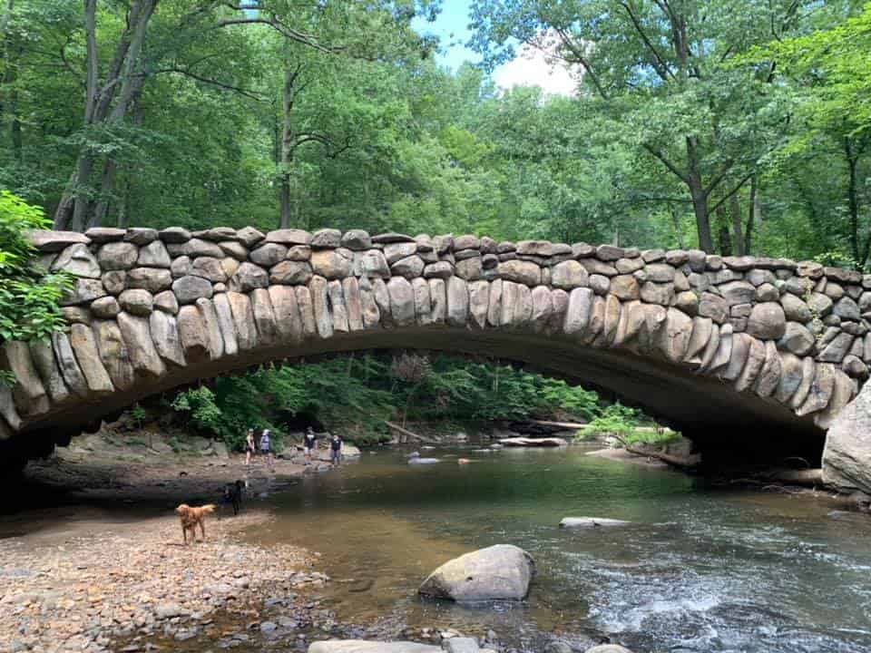
1. ROCK CREEK PARK
This is my favorite place to go for a hike in DC. It is truly an oasis of beautiful land inside of a bustling city.
It is one of the first national parks in the US following Yellowstone and Mackinac, created by an Act of Congress in 1890 to preserve 2,000 acres of land in NW Washington.
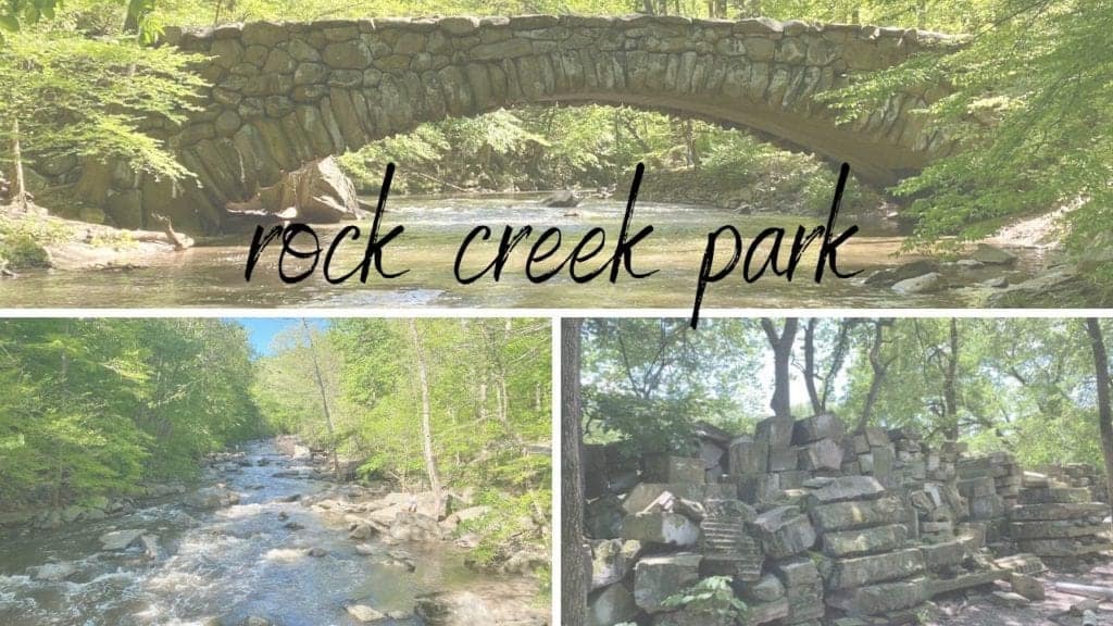
The beautiful Rock Creek is 32 miles long and twists through the park that originates in Montgomery County Maryland and empties into the Potomac River.
You will more than likely spot deer and tons of varieties of birds, and you may even see a few foxes run by.
Take a Hiking Tour
Join Free Tours by Foot for a hiking tour of Rock Creek Park.
Our 2-hour, 2.75-mile loop starts and ends at Peirce Mill on Rock Creek Park.
We walk over to Boulder Bridge, see the Mountain Overlook, walk to Rapids Bridge, and back down the Western Ridge Trail.
Along the way, we'll talk about the history of this area and some of the interesting finds (like the old Capitol columns).
Hiking on Your Own
One of my favorite hikes is the Western Ridge Trail, which is almost 9 miles.
It follows the creek at times and then colored trail signs take you to some of the highest elevations in the park (about 400 feet high).
Though there are many easier hikes in this park, I find this trail has the most solitude, especially the further north you walk.
If you enjoy biking and jogging, there are many paved paths throughout the park.
You aren’t allowed to bike on dirt paths, but many trail runners enjoy the terrain.
Beach Drive closes to traffic on the weekend and you are free to bike, rollerblade, and jog as you please on the main road from 7 am to 7 pm.
Historic Sites
For history lovers, there are some very cool things to see in this park.
A very bizarre but very interesting place to see is the old Capitol columns.
Behind a maintenance shed in a storage area for the National Park, there is a mysterious huge pile of stones from the Capitol building.
In 1958, the western front of the Capitol was renovated and some of the original sandstone was replaced.
Without any place to store these historic stones, it was decided to put them in the middle of the woods in Rock Creek.
It’s a very cool place to see, and quite surreal.
There are also remnants of a Civil War fort in the park called Fort DeRussy.
There were almost 70 Civil War defenses built around Washington in 1861 to protect the capital. Fort DeRussy is one of the rare ones that saw battle.
Nearby Fort Stevens was attacked by Confederate Jubal Early’s forces on July 11th and 12th, 1864. It was a bold attempt to try and breach the lines of defense.
Fort Stevens held off the attack with help from nearby Fort Derussy firing cannons at the invading Confederates.
Today Fort Derussy still has the original earthworks of the fort. For any history lovers, it’s worth a look.
Practical Details
It is free to enter the park.
It’s very easy to drive and park at Rock Creek along with many different entrances.
Here are the two most popular entrances.
Pierce Mill at 2401 Tilden Street, NW, Washington, D.C.
You can drive and park there or take the Metro to Van Ness Station and walk one mile to the entrance.
Rock Creek Park Nature Center & Planetarium at 5200 Glover Road, NW, Washington, D.C.
You can drive and park there or take the E-4 bus from Friendship Heights Station.
Get directions here.
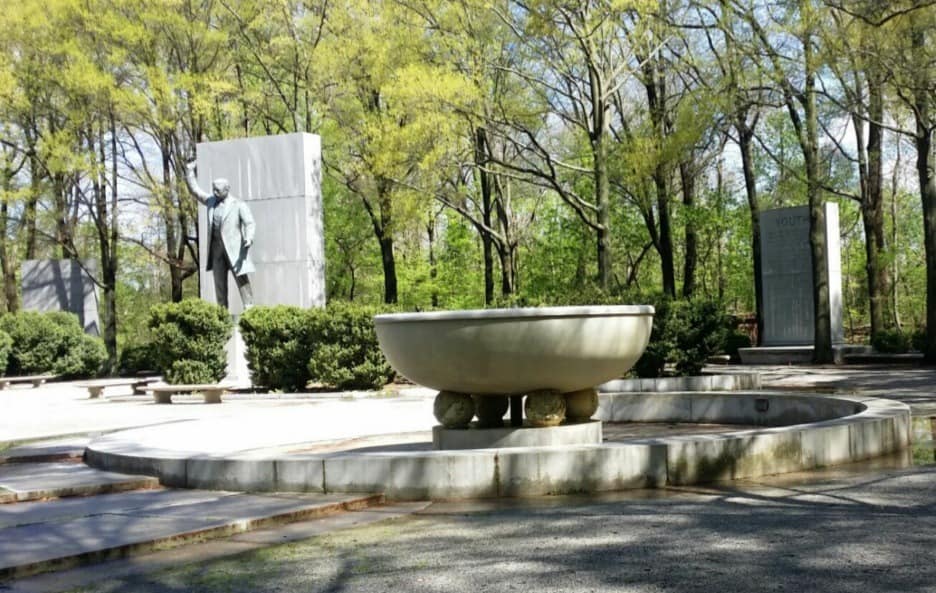
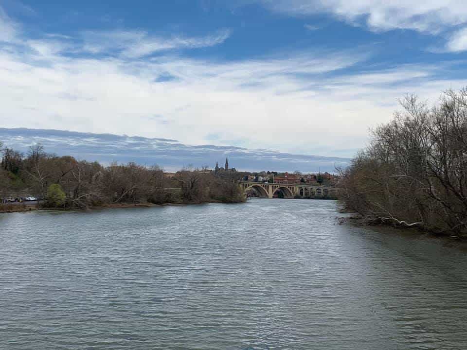
2. TEDDY ROOSEVELT ISLAND
This 88-acre island is very close to Georgetown and Arlington, VA. It is right off the Mount Vernon trail, which is a very popular running and biking trail.
This island is natural. It was once the home of the Nacotchtank tribe in the 1680s.
Let us guide you through the park on our 2-hour, 2-mile hiking tour of Teddy Roosevelt Island.
The hike is very flat and has very easy terrain.
We will take you to some of the best spots and tell you about the park's interesting history.
The island's history is detailed. George Mason’s family owned it from the 1700s to the 1830s and thus it was originally called Mason’s Island.
It was a testing site for bombs during the Spanish-American War in 1898.
There were several landowners until the early 1900s, then Washington Gas and Light owned it until 1931.
In 1931 a plan was made by the Teddy Roosevelt Association to turn the island into a living memorial honoring him.
Congress authorized this in 1932, but it wasn’t until 1960 that the funds were appropriated.
In 1967, a 17-foot statue of Teddy became the centerpiece of the island with lots of nature and wildlife surrounding him.
This is fitting for the man who helped establish our national parks in the United States.
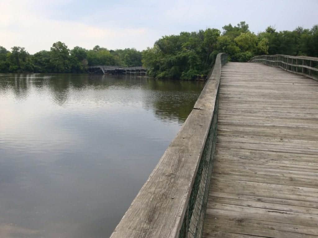
Several trails meander around the island that are great for hiking or jogging.
At one point it becomes a wooden path over some beautiful wetlands.
No biking is allowed, unfortunately.
Practical Details
It is free to enter TRI Park.
By car: It has a small parking lot that can be accessed by driving north on the GW parkway only.
It tends to fill up quickly on the weekends.
By Metro: The island is a 10-15 minute walk from the Rosslyn Metro station
Get directions here.
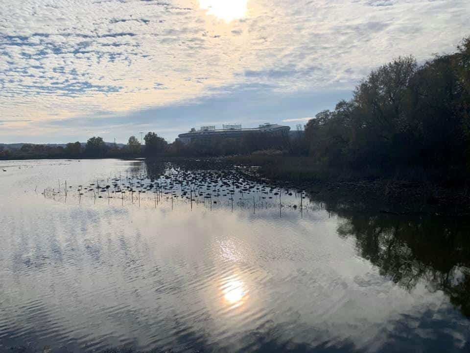
3. KINGMAN ISLAND
Kingman Island is a 40-acre man-made island that was completed in 1916. They dredged the Anacostia River for cleaning purposes and used that material to build the island.
There is a smaller island beside it called Heritage Island and both are connected by a footbridge. It is a lovely way to spend an afternoon walking the trails here.
It is not a hugely visited site, so the solitude is enjoyable. It is not strenuous hiking, but more for relaxing. You can hike both islands in about 2 hours.
It’s a great place to bring the family and the dog.
The islands are undergoing a lot of preservation and restoration currently which has brought more and more visitors in recent years.
They have a bluegrass festival every May on the island which has been hugely popular.
Practical Details
It is free to visit the park.
There are two pedestrian entrances - one on Benning Rd SE near the bridge, and one from the back of RFK Stadium Parking Lot #6.
Please note that there are some times events and soon-to-be construction here that may alter that entrance.
It is a 1-mile walk from the Stadium-Armory Station on the Blue/Orange/Silver line.
You can also take an X1, X2, or X3 bus to get there via Benning Rd. NE and Oklahoma Ave. NE stop.
Get directions here.
4. FORT DUPONT PARK
I mentioned earlier the defenses of Washington during the Civil War. This is one of the many forts that have been turned into wonderful parks, this one being the largest.
Since they all are under the jurisdiction of the national parks system, they are all on preserved land. For locals and tourists alike, these former defenses are very unique parks to explore.
The earthworks of Fort Dupont remain inside the nearly 400-acre park.
When you walk the trails inside the main park of Fort Dupont, you can feel why it was chosen as the location of several forts as it presides on several hills.
Several parks exist with Fort Dupont Park like Fort Chaplin Park, Fort Circle Park, Fort Davis, and Fort Stanton filled with 10 miles of connecting trails.
The trails are well-marked and easy to navigate.
You are welcome to jog, mountain bike, and rollerblade throughout this park. They even have an indoor skating rink open seasonally.
During the summers they even have concerts.
Practical Details
It is free to enter the park.
Entrances: Fort Dupont (not the same as Dupont Circle).
By car: Use this address for GPS- 3600 F and Minnesota St S.E. Washington, DC 20019
There is a parking lot at the Activity Center.
By Metro: The closest metro rail stops are Potomac Avenue and Minnesota Avenue on the orange line, Benning Road on the blue line, or the V7 and U2 buses on weekdays, and the V8 bus on weekends.
Get directions here.
5. GREAT FALLS PARK
A short 20-30 minute drive North of DC will bring you to 2 wonderful national parks filled with hiking trails, places to rock climb, excellent kayaking, and biking.
The name Great Falls might be a little deceptive in that there are no true waterfalls.
It is a section of the Potomac River that has some major rapids and they crash along some huge rocks.
George Washington partially funded a canal here to go around these rapids as it was unnavigable.
There are remains of the Patowmack Canal still intact at the main visitor center.
The historic C & O canal would later be built in the 1830s through this region to connect to the Ohio River to promote commerce, although it only reached Cumberland MD about 70 miles away.
Many hiking trails range from easy to difficult totaling 15 miles.
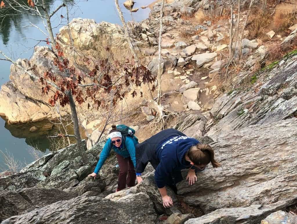
The most popular is the Billy Goat Trail, located in Chesapeake and Ohio Canal National Park, which is an almost 5-mile trail made up of 3 sections called A, B, and C through some challenging terrain.
You are walking on some huge boulders on most of the hike and even have to climb a few sections.
There are some incredible views of the Potomac throughout but it is unsafe for young children and dogs. You can access the Billy Goat Trail either in Virginia or Maryland side.
You can reach the B and C sections on the Maryland side at Carderock Recreation Area for free.
Trail A is best from the Great Falls Visitor Center.
Practical Details
It costs $10 if you arrive on foot, bike, or rideshare (under 15 is free).
If you come by car it is $20 per car. There is a $15 per car parking fee,
Entrances: Great Falls Street Address: 9200 Old Dominion Drive, McLean, VA 22102
It is about a 5-minute ride from the Spring Hill or Greensboro stations on the Silver Line, but you should be aware that there is limited cell service and no wifi to plan a return trip if you're taking a rideshare.
Parking is free at this location.
Get directions to the Great Falls Visitor Center here.
Get directions to the Carderock Area here
6. PRINCE WILLIAM FOREST PARK
To me, this is a hugely underrated park that is very easily reached within 45 minutes from Washington DC (depending on traffic on I-95.)
There are 16,000 acres here and truly you will feel worlds away from DC as it never feels overly crowded.
The park began as a relief camp for children during the Great Depression and was later turned into a State Park in 1948.
There are 37 miles of hiking trails to explore. You will end up most certainly beside Quantico Creek as it meanders through this whole park.
Yes, that Quantico, where the FBI trains and a huge Marine base is located nearby.
I’ve been hiking there before and heard some mysterious explosions off in the distance, which was probably gunfire training.
My favorite hike is the South Valley Trail, which is over 9 miles. All of the trails connect so it’s easy to sample different ones each time you go.
The area is excellent for dog walking.
You can camp here as well and will need a permit which is easily obtained with all the information on their website. They even have cabin rentals.
The cabins at campsite 3 were constructed by the CCC during the New Deal Era and are on the National Register of Historic Places.
Practical Details
There is a $20 per car fee to visit this park and the pass is good for a week.
An annual pass is only $35, so well worth your money if you plan on returning a few more times.
Entrance: The street address of the visitor center is 18170 Park Entrance Road, Triangle, VA 22172. There is a parking lot.
Get directions here.
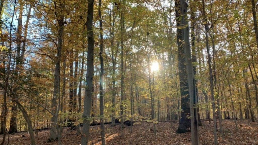
7. CATOCTIN MOUNTAIN PARK AND CUNNINGHAM FALLS STATE PARK
This beautiful park is a bit further outside of the Washington Area.
I would plan for a good hour-long drive, maybe 1.5 depending on where you are driving from.
This area overlooks the beautiful Monocacy Valley in Northern Maryland. This park was also a CCC project like Prince William Forrest to create a recreation area in this region.
You may have heard of a little retreat in this park called Camp David.
FDR was the first President to utilize this area which he called Shangri La, modeling it after his little White House in Warm Springs, GA.
Dwight Eisenhower would later rename it in honor of his son.
Unfortunately, the camp is off limits but you can drive up to the gate. It’s a bit surreal to see all the security gates in the middle of the woods.
This massive park boasts over 6,000 acres with a huge amount of hiking and outdoor recreation including fishing, biking, and camping.
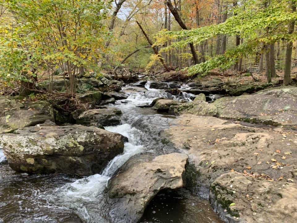
My favorite place to hike is Cunningham Falls. It’s a very easy but peaceful hike and the main attraction is the falls at the end. It’s not a major waterfall, but still worth the time.
For more of a challenge, the Catoctin Trail is nearly 10 miles long and offers great views and vistas along the way. This park would require multiple visits to truly enjoy it all as a whole.
I would even recommend a weekend away here either camping or renting a cabin.
Gettysburg, PA is just over the state line and you could throw some Civil War history in as well. Nearby Monocacy Battlefield is worth the time as well.
Practical Details
The park is free to enter.
Entrance and Parking: The Visitor Center is at 14707 Park Central Road, Thurmont, MD.
There are two parking lots at the Visitor Center which are free.
Get directions here.
OTHER PLACES TO HIKE IN WASHINGTON DC:
Not too far from downtown DC, there is a surprising amount of green space in the city.
- Kenilworth Aquatic Gardens - walk unpaved trails around 700 acres of water-loving plans.
- Anacostia Trail
- Dumbarton Oaks Park (not to be confused with the historic home and garden!)
- Mount Vernon Trail
- C & O Canal
- Hains Point
- National Arboretum
- Capital Crescent Trail
TIPS FROM LOCALS AND TRAVELERS
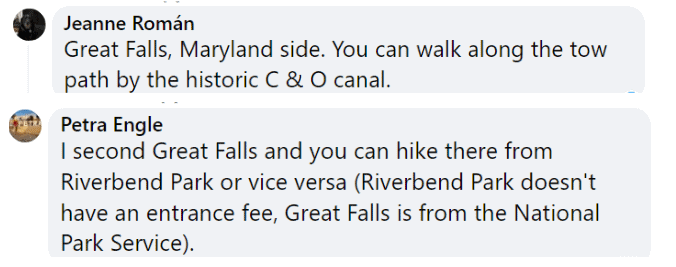
Here are some thoughts on the best hiking in Washington DC from members of our Washington DC Travel Tips Facebook group.
Again, you don't have to join the group to read the posts, comments, and recommendations.
Great Falls, included in this post, is quite popular!
Andrea gives Rock Creek Park a thumbs up for its wooded trails and suggests another park not mentioned in this post.

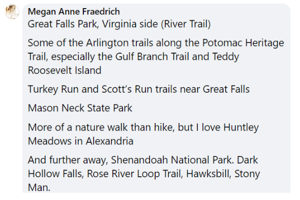
And here we have Megan, who clearly loves to hike!
Finally, Francine recommends trails in Wheaton, MD, not too far from DC.

For even more advice on hiking or any topic, why not ask a question of your own in the group?