New York City has over 32,000 streets and avenues. Some of these streets, like Broadway, are known worldwide.
As a local tour guide who leads hundreds of guests each week through NYC’s streets, I rarely meet a guest who hasn't heard of Broadway.
In this post, I’ll tell you the stories behind some of the most famous streets and lesser-known streets and what makes them interesting.
When you add up all the streets our local tour guides cover on our many walking tours, we take our guests to hundreds of them!
While I could go into detail about dozens of more streets in this post, I will start you off with just a few.
As you explore the city, consider this: every street name has a story behind it!
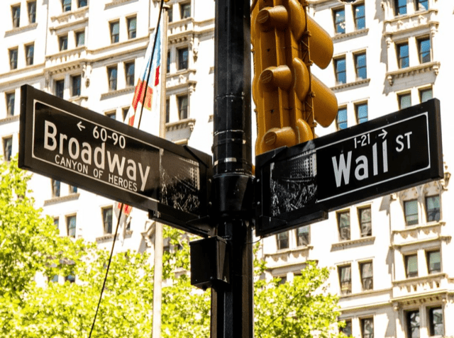
Broadway
As I mentioned above, Broadway is perhaps the most famous street in the Big Apple.
Just about every one of the guests on our guided walking tours has heard of it.
This is due mainly to the fabulous Broadway shows that hundreds of thousands of people flock to each year.
This main thoroughfare, the longest in NYC, runs 13.5 miles starting at the tip of Manhattan and continuing to the northern boundary of the Bronx (one of the city’s five boroughs).
Some of my fellow tour guides and I at Tours by Foot NYC have walked Broadway from top to bottom on foot in one session. It takes 6 1/2 hours!
If you are new to the city or visiting and have some spare time, I encourage you to do this walk.
It’s a pretty cool way to get to know NYC neighborhoods as Broadway passes through dozens of them.
Several of our guided walking tours in different parts of the city walk on Broadway briefly.
Our Lower Manhattan guided walking tour meets at the southern end of Broadway at the bottom of Manhattan.
We meet at the iconic Charging Bull sculpture and take an Instagram-worthy shot.
Pose in front of the bull or the rear. I prefer the front since the bull is anatomically correct!
As a history buff, I adore talking to my tour guests about Lower Broadway.
Before the Dutch arrived in the 1600s, native Americans carved a trail along what was later turned into an 80-foot wide path in the early 17th century.
The Dutch named it Brede Wegh meaning “broad way”. When the British took over, the name became Broadway.
The southern end in Lower Manhattan was the site of the reading of the Declaration of Independence in 1776.
Two notable landmarks along this part of Broadway are the gorgeous Trinity Church and the Woolworth Building, once the tallest building in the world.
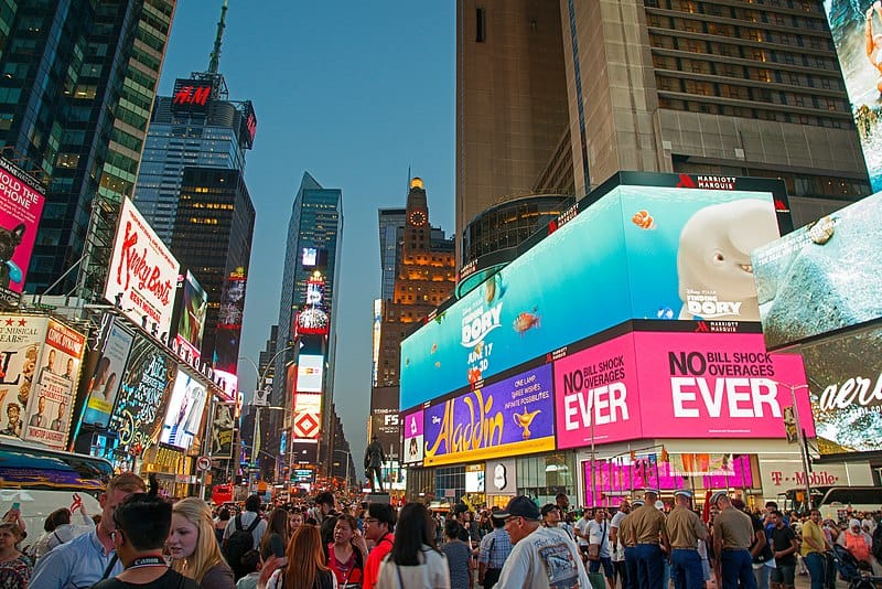
Broadway also passes through Midtown Manhattan and Times Square, which we visit on our Midtown Manhattan tour.
As Broadway makes its way uptown, it passes through the lovely Upper West Side, just a few blocks from Central Park.
Fifth Avenue
Fifth Avenue is another famous street and has very different personalities depending on which section of the avenue you are on.
In Midtown Manhattan, it’s known for being one of the best shopping districts.
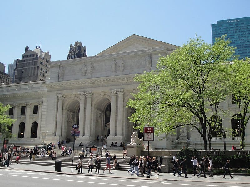
You’ll find some of the city’s architectural gems like the Empire State Building, the New York Public Library, St. Patrick's Cathedral and one of my favorites, the Flatiron Building.
On Manhattan’s Upper East Side, you’ll find world-class museums, like the Metropolitan Museum of Art and apartment buildings for NYC's wealthy.
When the avenue was laid out in 1824, it started as a simple country road called Middle Road.
It started at Washington Square Park and grew to 142nd Street in Harlem.
As Manhattan developed, Fifth Avenue took on a fundamental aspect of city planning.
It split Manhattan in half when it came to naming east-west streets of which there now are 214!
The numbered cross streets east of Fifth Avenue begin with East, for example, 42nd Street east of Fifth Avenue is named East 42nd Street (or E. 42nd St. for short).
Likewise, the numbered cross streets west of Fifth Avenue begin with West as in West 42nd Street (or W. 42nd St. for short).
I’d say that understanding the East v. West element of street names is one of the most important things for visitors to know about New York City so you can find your way around.
An explanation of how to find your destination easily can be found in our post, New York City's Grid System Explained.
Wall Street
Located in Lower Manhattan, this street was originally called Waal Straat by Dutch settlers.
The most frequent question I hear from tour guests is “Was there a wall on Wall Street?”
Yes! The Dutch wooden defensive wall was built in 1653 to keep out hostile Native Americans.
As far back as Dutch times, trading and commercial transactions were conducted in this area, now known as the Financial District.
At the corner of Wall Street and Broad Street stands the New York Stock Exchange.
It’s famous for being the American hub for trading stocks. It’s the largest exchange in the world.
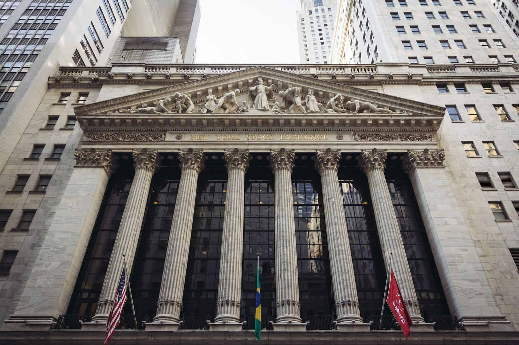
I bring overseas friends here to tell them just how much American history took place on this site.
Most notably, Federal Hall is the site of the first capital of the U.S. and where George Washington was sworn in as the first president.
One lesser-known event took place at the Morgan Guaranty Trust Building built in 1913.
In 1916, a bomb was set off killing 39 people.
Anarchists were most likely behind this unsolved case. I can’t think of a place more representative of capitalism!
It’s these nuggets of history that make New York so interesting to me and many others.
The intersection of Wall and Broad Streets is covered on our Lower Manhattan guided tours where you’ll hear much more detail.
TIP: There are public bathrooms inside Federal Hall.
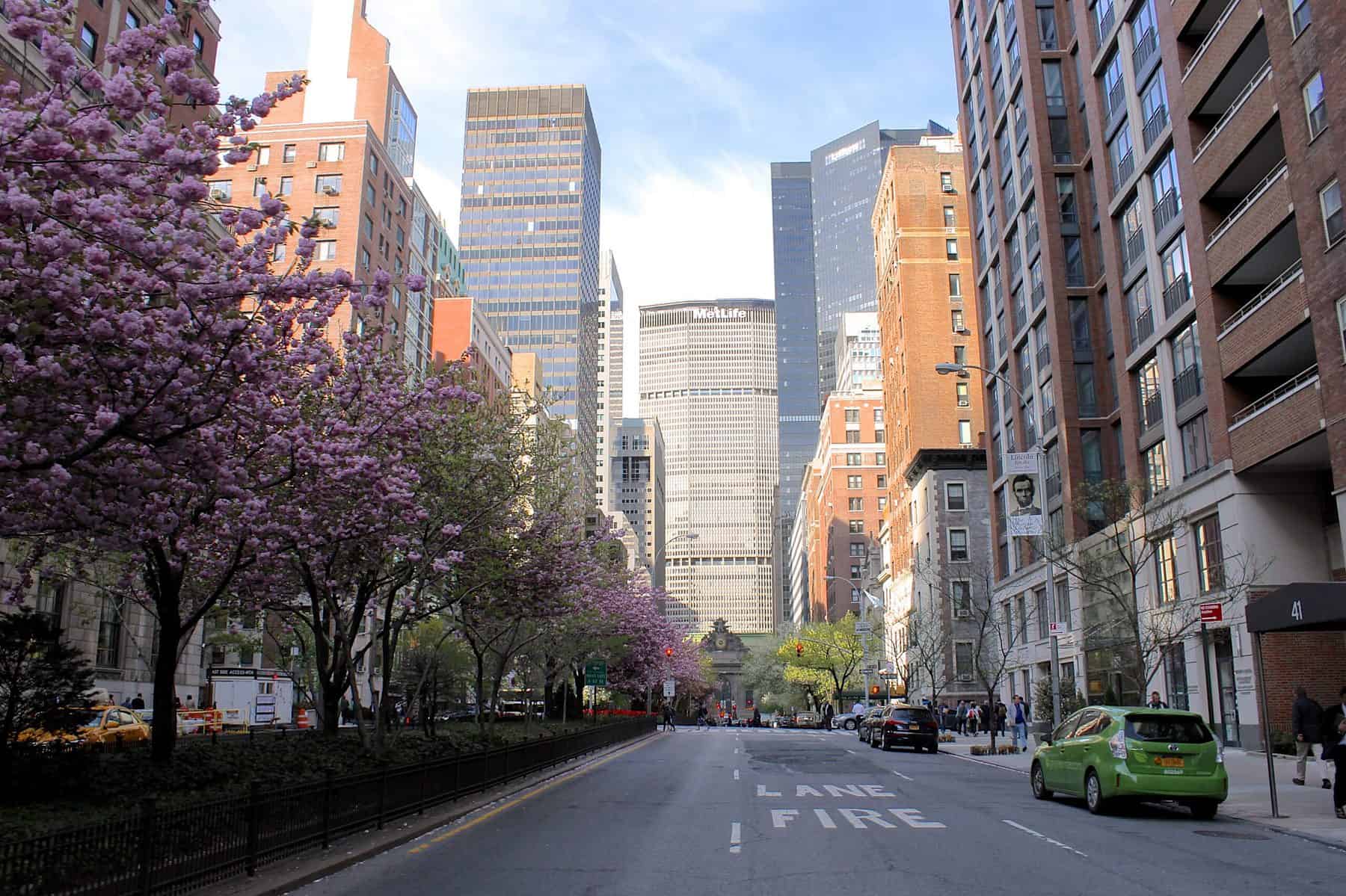
Park Avenue
Park Avenue is another famous street known for its outrageously expensive apartment buildings and glass tower office buildings.
Most people recognize Park Avenue from the iconic view looking south toward the boxy, reflective MetLife Building (1963) with the handsome Beaux-Arts Helmsley Building (1929) in front of it.
It’s also the location of the art deco Waldorf-Astoria Hotel (1931) at 301 Park Avenue between E. 49th and E. 50th Streets.
If you find yourself in the area, I recommend walking into its lush lobby, though the hotel is closed for renovations until late 2024/early 2025.
Though Park Avenue is home to the rich and famous, it wasn't always so elegant.
In the 1830s, Park Avenue (below E. 40th Street) was known as Fourth Avenue and was covered with a railroad track between E. 34th to E. 40th Street.
In the 1850s, the trains stopped running and the tracks were covered with a grassy lawn.
The area was used as a park and the blocks between E. 34th Street and E. 38th Street came to be called Park Avenue.
Wealthy people started building stately homes and apartment buildings in the 1930s.
Today, Park Avenue is one of the richest streets in NYC.
In 2014, 432 Park Avenue, a 1,400-foot-tall residential skyscraper was built. In 2022, the penthouse apartment was listed for sale for $170 million.
It was the tallest residential building in the Western Hemisphere, though as of 2024 it is ranked at number three.
It is so tall that I can see it where I live in Brooklyn, nearly nine miles away.
Both 432 Park Avenue and 520 Park Avenue are part of "Billionaire's Row" along with some residential skyscrapers on the southern end of Central Park.
TIP: You can get a great view of “Billionaire's Row”, Central Park and more from the Cantor Rooftop Garden at the Metropolitan Museum of Art.
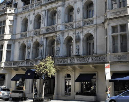
Madison Avenue
While known to many for its designer boutiques, I think of it as an avenue with architectural gems.
Madison Avenue was developed in 1836 and named after Madison Square Park where the avenue begins at E. 23rd Street.
In turn, the park was named after President James Madison who died in 1836.
Many of the sumptuous landmarked buildings along Madison Avenue between E. 60th and E. 80th Streets on the Upper East Side date back to the late 1800s and early 1900s.
One combination of shopping and architecture is the Ralph Lauren flagship men’s store on Madison Avenue between E. 71st and E. 72nd Streets.
It's housed in a gorgeous French Renaissance Revival mansion built in 1898.
At 225 Madison Avenue at E. 36th Street is the beautiful Morgan Library & Museum.
It holds J. Pierpont Morgan’s magnificent collection of rare books and manuscripts.
I highly recommend a visit here, especially since it has free hours on Fridays from 5 pm to 7 pm.
In a way, Madison Avenue is at the crossroads of business and pleasure.
It was once home to the advertising industry, beginning in the 1920s.
But if like me, you are a fan of the indulgent TV show Mad Men, you know this already!
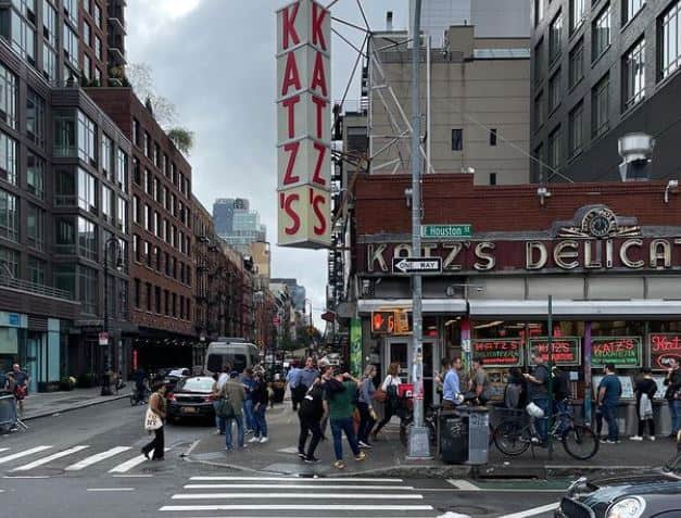
Houston Street
This street is a major east-west thoroughfare in Lower Manhattan running from the East River to the Hudson River.
Those of you who are unfamiliar with this street, you'll almost certainly pronounce it the same way you would pronounce the city in Texas.
It's actually pronounced ‘HOW-stun’ and I always feel a little bad correcting people because who would know this except New Yorkers?
The street is named for William Houstoun (pronounced 'HOW-stune'), a delegate to the Continental Congress gathering, which took place just after the end of the Revolutionary War.
There’s no date or explanation for when and why the second “u” was dropped from Houstoun and the name became Houston.
Those of us who spend a lot of time in Lower Manhattan know that Houston Street is the boundary of so many cool neighborhoods.
On the east, it is the border between the East Village to the north and the Lower East Side to the south.
West Houston Street borders Greenwich Village to the north and to the south is SoHo (an acronym for SOuth of HOuston).
If I had to name only one stand-out fact about Houston Street, it's that it is the home to three famous food establishments since the early 1900s!
These are Katz’s Delicatessen, Russ & Daughters and Yonah Schimmel Knishery, which are stops on our Lower East Side Food Tour.
Delancey Street
Like Houston Street, just three blocks north, Delancey Street is another east-west thoroughfare in the Lower East Side.
It runs between the Bowery on the west and the Williamsburg Bridge (1903) on the east.
Like so many streets in Lower Manhattan, Delancey Street was named after a pre-Revolutionary War wealthy landowner, in this case, James De Lancey.
He was from a French Hugonaut family that owned a 300-acre estate.
This map from 1770 shows some of the estate. You can see his name on the map.
I love looking at old maps of my city and if you are interested, take a look at the Historical NYC Maps & Atlases collection from the New York Public Library.
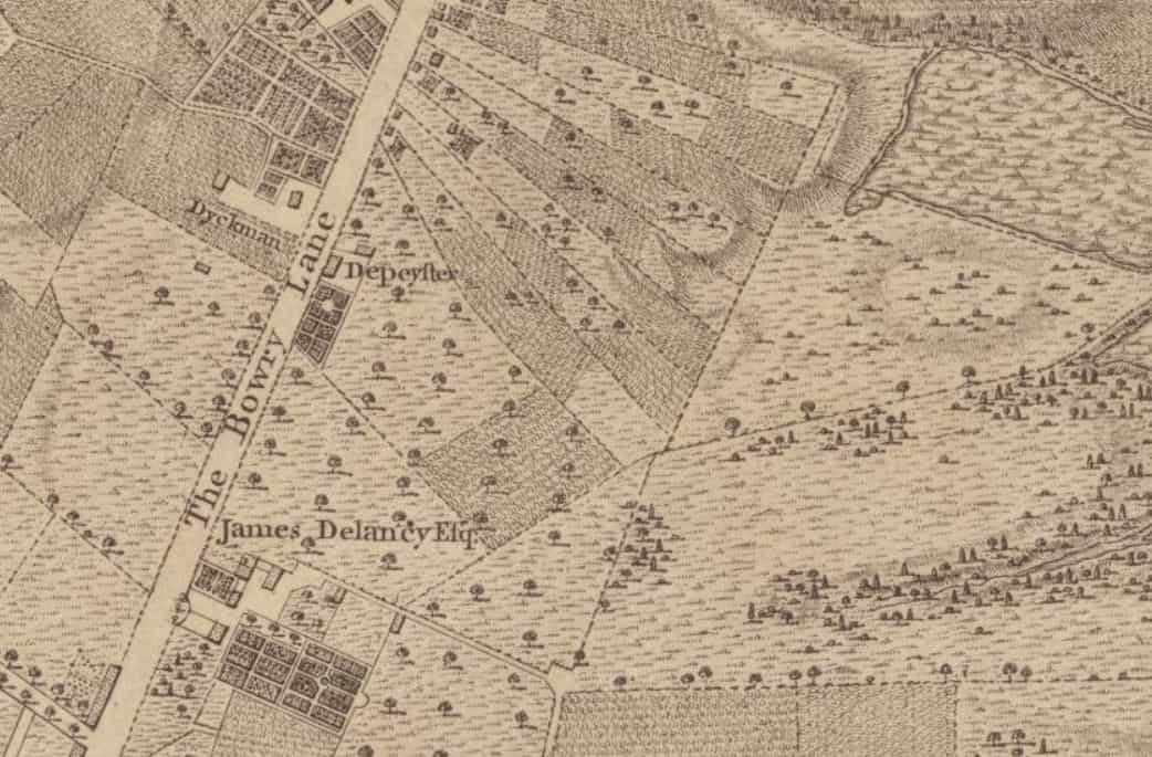
De Lancey sided with the British in the war so after the war De Lancey’s lands were confiscated.
Along the north side of the De Lancey estate was a lane that became Delancey Street.
If you are into movies, you may be familiar with Delancey Street from the 1988 romantic comedy, Crossing Delancey.
MacDougal Street
Located in Greenwich Village, MacDougal Street is one of the most famous streets in NYC as it played an important role in both the 1950s beatnik era and the 1960s folk and rock music scene.
One landmark music venue on MacDougal Street is Cafe Wha? where many musicians got their start, like Bob Dylan and Bruce Springsteen.
Our Greenwich Village walking tours visit MacDougal Street.
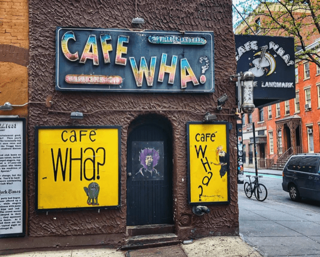
MacDougal Street is named for Alexander McDougall, a merchant who was a major general in the Revolutionary War.
Today, MacDougal Street is a vibrant, lively street lined with restaurants, cafes, and music venues.
It’s worth a visit and you can see my suggestions for what to do here.
Gay Street
Sandwiched between Waverly Place and Christopher Street in Greenwich Village, Gay Street is one of NYC’s shortest streets -- it is just one block long!
In the late 18th century, the street was an alley for horse stables.
By 1827, according to historical documents, Gay Street was an official city street.
The origin of its name is not definitive and one possibility is that it is named after the Gay family that lived in the area.
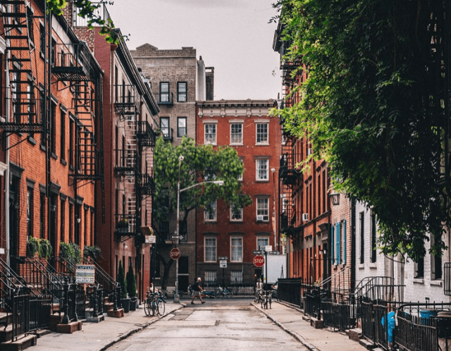
Though the street was widened in 1833, it is still tiny, one of the reasons it is so charming.
It is pure coincidence that Gay Street is in a neighborhood known for its large LGBTQ community.
The street is around the corner from the Stonewall Inn, the birthplace of the LGBTQ rights movement.
Minetta Lane
Another tiny, easy-to-miss street in Greenwich Village is the one-block, curved Minetta Lane.
It's one of my favorite streets in New York City and one that my tour guests find really interesting.
Here's why.
This street is named for the freshwater Minetta Creek running underneath it. Yes, there is a tiny stream of water under the pavement!
The name comes from the Algonquin Native American tribe word Mannette, translated as "Spirit Water" or "Demon Water."
The Dutch referred to the creek as Mintje Kill, which translates approximately to "little tiny stream."
The creek was filled in during the mid-19th century, but a trickle of it still runs underneath Minetta Lane.
Surrounding the creek was what was known in Dutch times as t' Erf van Negros, translated as ‘The Land of the Blacks’.
It was settled by people of African descent north of the wall of New Amsterdam from about 1643 to 1716.
Later, the area was called Little Africa where many of New York City's emancipated slaves lived.
In 1896, American author Stephen Crane wrote that Minetta Lane and its intersecting street, Minetta Street had recently been "two of the most enthusiastically murderous thoroughfares in the city."
It’s hard to believe this when you stroll down this peaceful, quiet street!
Doyers Street
Yet another tiny street is the 200-foot-long Doyers Street in Chinatown, named for Hendrick Doyer, a Dutch immigrant who owned a brewery there in the 1800s.
By the late 1800s, Doyers Street and the surrounding area were rapidly turning into an enclave of Chinese immigrants.
By the early 1900s, the population was predominantly Chinese.
Doyers Street is not only short, but it also curves at nearly a 90-degree angle.
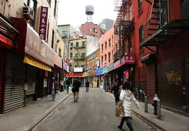
When the street became a hotbed of extremely violent Chinese gang warfare in the early 20th century, it was called the “Bloody Angle” or "Murder Alley".
Today, the only dangerous thing about Doyers Street is that it is tempting to eat too much at the delicious Nom Wah Tea Parlor, the oldest, still operating dining establishment in Chinatown.
Nom Wah is great for a sit-down meal but if you want to grab a snack, go to Mei Lai Wah Bakery at 62 Bayard Street.
It's a stop on our Chinatown and Little Italy Food Tour and for good reason. They make the best roast pork buns in Manhattan!
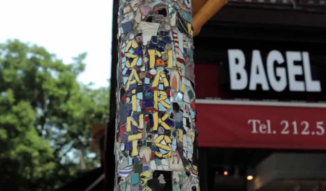
St. Mark's Place
St. Mark's, a three-block stretch of E. 8th Street in the East Village, is famous for being the coolest street in New York City.
Nearly 24 hours a day the street is busy, with people in bars, restaurants, music clubs or just hanging around on the street.
During my college years at nearby New York University in the late 1980s, , I spent too many hours here to count!
St. Mark's Place was named in the 1830s for the nearby church, St. Mark's in the Bowery.
One of the must-see things on St. Mark's and the surrounding streets is the Mosaic Trail, a path of over 80 lampposts covered with mosaics representing historic locations and events in the East Village.
For almost a century, starting in the 1900s, St. Mark's Place was a hotbed of cultural, political, and even gangster activity.
In the 1910s, Russian Marxist revolutionary Leon Trotsky lived on St. Mark's Place. In the 1920s, mobster shootouts occurred on the block.
In the 1950s, Beatnik writers Jack Kerouac and Allen Ginsberg hung out at a cafe on St. Mark's Place.
In the 1960s, hippies took over St. Mark's Place and radical political activists Abbie Hoffman and Jack Rubin lived on the street.
The punk rock scene flourished in the 1980s, but by the 1990s, gentrification arrived, and St. Mark's Place ceased being a center of counter-culture.
Still, it's a fun, vibrant street and worth checking out!
Our East Village Food Tour spends some time on this historic, amazing street!
Fulton Street and Old Fulton Street
Both Fulton Street in Lower Manhattan and Old Fulton Street in DUMBO, Brooklyn are named for Robert Fulton who is credited with inventing the first steamboat in 1807.
Up until 1814, the only way people could travel between Manhattan (then the City of New York) and the village of Brooklyn, was by rowboat and canoe.
On May 10, 1814, Fulton launched the first steamboat ferry between the two cities and with that, a rapid transformation began.
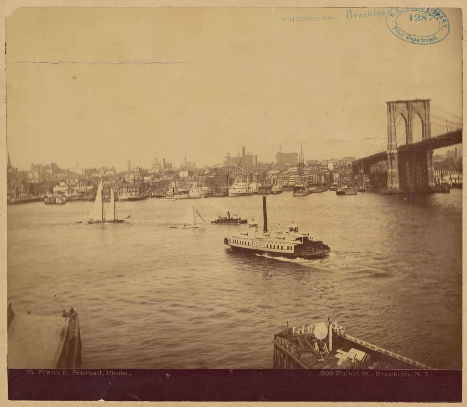
People could live in suburban Brooklyn and commute to work in Manhattan by ferry.
In less than 50 years, Brooklyn’s population had swelled and the then-city of Brooklyn was the third-largest city in America.
The Brooklyn Bridge was completed in 1883 and the ferries eventually became obsolete.
Our Across the Brooklyn Bridge & DUMBO Tour visits the Fulton Ferry Landing where it all began.
TIP: At the end of Fulton Street in Manhattan is the South Street Seaport where you can get amazing views of the Brooklyn Bridge.
I like to get a coffee and sit on the benches at Pier 15 along the water and take it all in. It's a really nice spot. Check it out!
Canal Street
Canal Street is named so for the unsurprising reason that a canal once existed here.
The canal was dug in 1808 to drain waste from Collect Pond in Lower Manhattan until 1811.
In the early 1800s, immigrants settled in Lower Manhattan and the pond became a receptacle of waste.
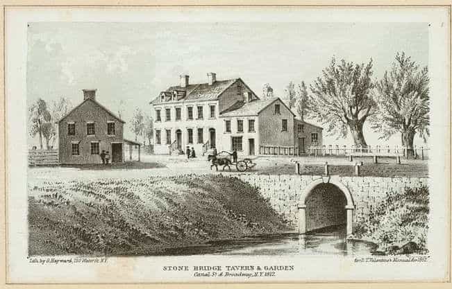
The city decided to drain the pond and did so by building a canal that led to the Hudson River.
Even after the pond was drained, the canal continued to smell foul odors.
In 1819, the city filled in the canal, paved it over and we ended up with … Canal Street!
Today, Canal Street is the dividing line between Chinatown and Little Italy, which means you can get great food on either side of the street.
TIP: When tour guests ask me where to find knock-off handbags, perfume, sunglasses, watches and more, I tell them to head to Canal Street between Broadway and Mulberry Street.
Bowery
Like Broadway, Bowery is one of the oldest thoroughfares in Manhattan.
Bowery runs through Chinatown, Nolita, the Lower East Side, and the East Village.
The original Dutch name bouwerij means farm road and it went to the enormous farm property of Peter Stuyvesant.
Stuyvesant was the last director-general of New Netherlands before the British drove the Dutch out in 1644.
Bowery is the anglicized version of the original street name.
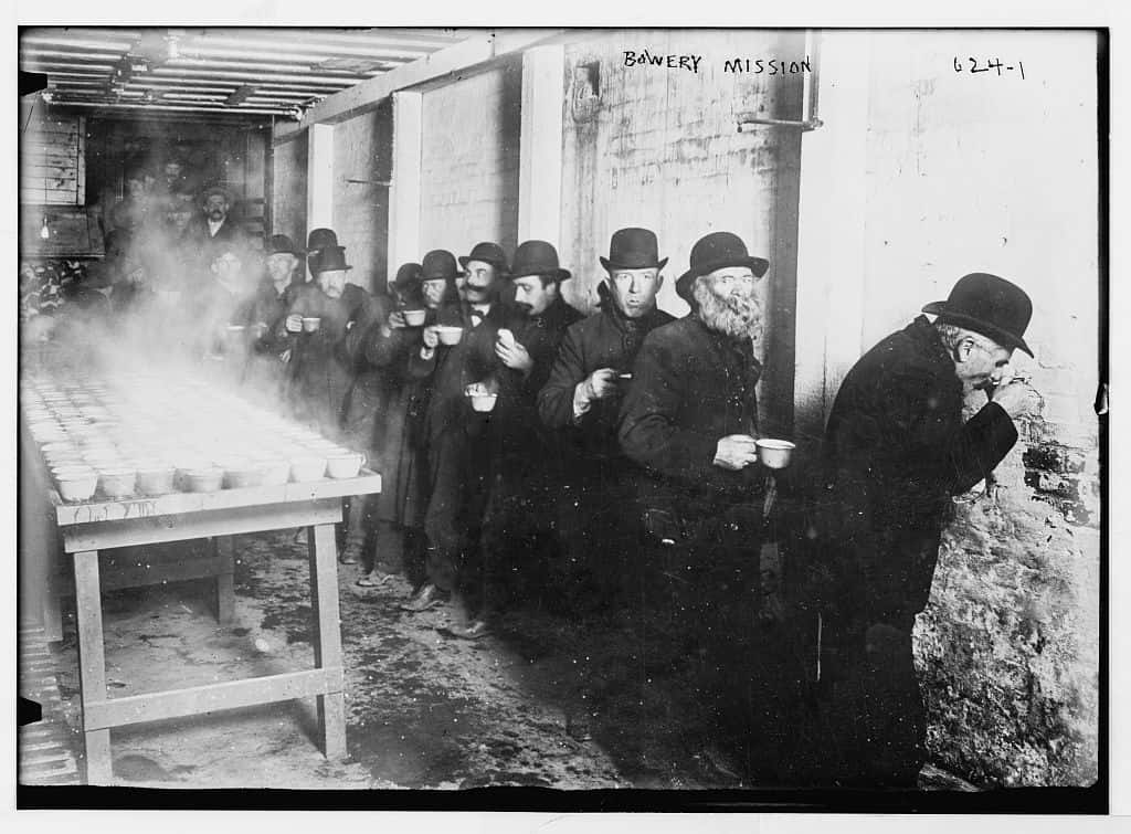
In the early 1800s, Bowery had theaters spouting up as well as handsome homes for the wealthy.
By the time of the American Civil War in the 1860s, the area had brothels and saloons.
Starting in the 1940s the Bowery was New York City's "Skid Row".
In the late 1970s, the Bowery and the surrounding streets underwent revitalization and gentrification.
Punk rock was born on the Bowery at the iconic music venue CBGB, a haunt of mine in the 1980s.
Today, Bowery and its surrounding streets are filled with boutiques, expensive apartments and hip restaurants.
TIP: John Varvatos has a shop where CBGBs was, at 315 Bowery. If you were a former (or current) punk rocker, step inside. Besides clothing, it's filled with memorabilia from CBGB.
Washington Street
Located in DUMBO, this street is the site of one of the most photo-worthy spots in New York City.
The sloped cobbled street is bordered by red brick industrial buildings from the late 1800s (now condominiums).
At the end of the street stands the Manhattan Bridge, more than 100 years old. The entire setting harkens back to another era.
When you stand on Washington Street between Front and Water Streets, you’ll have a picture-perfect view of the Manhattan Bridge with the Empire State Building in the distance framed in the bridge’s arch.
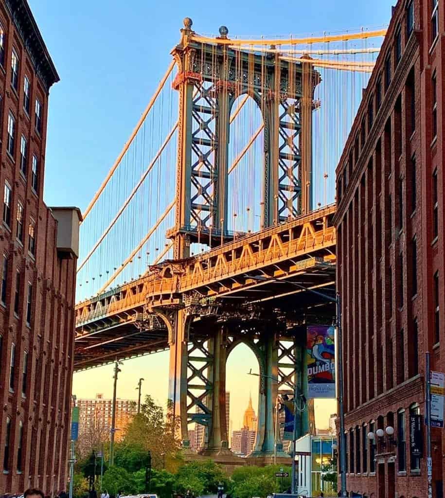
It’s one of the most iconic images of NYC, immediately recognizable to so many people from professional photographs, postcards, TV shows, and movies, most notably “Once Upon a Time in America”).
This is one spot where I always bring out-of-town guests to take pictures.
I must warn you, it can be very crowded, so go very early in the morning or late at night if you don't want strangers in your picture.
Stone Street
Located in Lower Manhattan, this is one of NYC’s oldest streets, dating back to the Dutch era.
In 1658 it became the first cobbled street in the colony of New Amsterdam.
The segment of what is now Stone Street between Whitehall to Broad Streets was named Breuers Straet translating to Brewers Street. And yes - there were lots of breweries there!
When the British pushed out the Dutch, the street was renamed Duke Street.
When the Americans pushed the British out, the street was renamed Stone Street for the cobblestones.
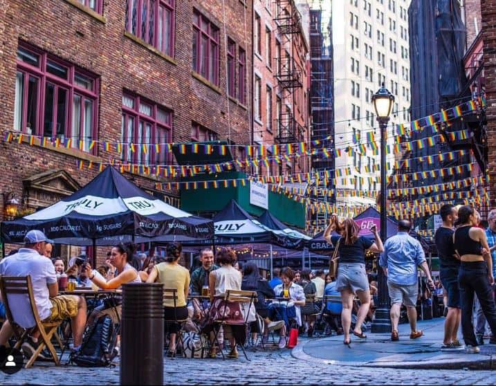
The Great Fire of 1835 destroyed most of the structures on the street, and afterward, lofts for dry goods merchants appeared.
Over the decades, Stone Street was neglected and it wasn't until the late 1990s that the street was restored.
Today, the two-block-long section between Hanover Square and Coenties Alley is a charming pedestrian-only street and is lined with restaurants.
In the nice weather, tables are placed outside and it’s a popular spot for workers and tourists to grab a bite to eat.
